
Earlier this week, on Instagram, a photograph of authors Cheryl Strayed and Elizabeth Gilbert together, at an event – named Brave Magic – in the States, popped up on my feed, and I could not give it quite enough love.
Being the sort of backwards, retrospective spod that I am I do have a tendency to cotton on to trends some good few years after they've passed; I read Eat, Pray, Love (Elizabeth Gilbert) a good ten years after its publication and popularity, and as for Wild (Cheryl Strayed), I read that three years ago, three years after its publication and initial popularity.
Of these two, Wild is the one that stuck with me most prominently, although I adore Elizabeth Gilbert and have been following her emotional story of recent years on social media for a while now.
While Cheryl Strayed's life journey has been notably different from my own her book was the one that resonated with me most: woman undertakes insanely long walk for 'funsies'.
And after an earlier aborted attempt to watch the film adaptation featuring:
 |
| {This gag never gets old.} |
I finally gave the film a go two weeks ago.
No regrets.
But why now?
Well, let me tell you for why. Now.
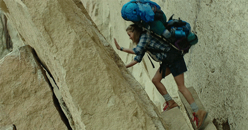
Thirteen days ago I packed up a ludicrously heavy rucksack (in the spirit of Strayed):

and Went West (life is peaceful there) to walk part of the South West Coast Path.

It felt like something I needed (and wanted) to do.
Even in spite of my cacophony of doubts about the whole idea following the Wye Valley Challenge.
Over a series of months I had plotted and planned this trip, beginning with a frankly ludicrous pipe dream of walking the whole Path, then whittling that down to beginning in Poole and walking half of it, to beginning in Teignmouth, then in Torquay, and eventually deciding to start off at Paignton, and walk around the coast, on the path, as far as Hope Cove.
 |
| {Yeah, when you look at it like this, it's still quite a long way.} |
The distance from Paignton (pier) to Hope Cove is 47.6 miles [76.6km]*
– South West Coast Path website
* I didn't walk all of that.

I also had access to several mapping sites, before alighting on Mapometer as the most trustworthy (according to the wise sage Pa QB). With additional back-up from Ordnance Survey because, why wouldn't you go with the OS?
Mere days (perhaps even a mere day) before I left, I was truncating my trip further when it dawned on me – with some coercion from that wise sage Pa QB – that endeavouring to walk 20+km in half a day (according to the SWCP calculator) was, even by Harwood standards, overambitious.
It is a truth universally acknowledged that a Harwood, left to her own devices, must challenge herself beyond all reasonable human capacity.
But there are limits.
Harwoods hate to admit those limits:


but they do exist, normal, innocent-looking Lindsey Lohan and crazy Dutch woman who can only dance with her arms.
And off I went.
Monday 10th September
Day One: Paignton to Dartmouth (via Churston)

 |
| {Ready to rock and roll!} |
You'll notice that I have my Nordic walking poles strapped to me in the photo above.
These proved both a burden and a blessing. Thankfully the latter more than the former, but it was a fairly close call.
After hopping onto the ridiculously overcrowded 8.14am to Reading, asking politely for a seat then sitting on the very edge of said seat as far as Guildford with my rucksack on to avoid having to remove it and take up more space ... I made a good connection and had a fairly uneventful, quiet journey towards Newton Abbot. I even read a book (which was written by a former editor):

Ma QB: [13:36, 9/10/2018]: Have you come to a standstill? X
Me: [13:37, 9/10/2018] No, just been sorting rucksack at Paignton station. About to head off now if I can find roads with signs on them! X
I should mention also at this point that in addition to all my scrupulous route-planning, and AirBnB/regular BnB bookings (all done and dusted way back in June) I had also subscribed to the Life360 app and set up two circles: one for family, one for my virtual walk buddies, whom I'd recruited in advance. The app 'tracked' my whereabouts, and could tell my followers where I was, and if I'd come to a stop at which point I'd be able to reassure them I was just finding my bearings, and not in the sea or anything dramatic like that.
Time for a cheeky name check, I think:
All gratitude for keeping me virtual company to: Kate (Monday), Ray (Monday and Wednesday evenings), George (Tuesday), Jos (Tuesday evening) and Jo (Wednesday).
Thanks also to Ma QB, Natalie, Charlie, Inger and Maz for their check-in messages.
Mapometer and Google Maps both turned out to be hugely instructive (as were my scrupulously written instructions which were based on the official South West Coast Path walking guides – hey, I'm verbal, not visual, it's just how I roll), and I found my way on to the path in no time.
 |
| {I'd say that was a fair indication that I'm going the right way ...} |
 |
| {At the start!} |
Walk along Preston and Paignton sea fronts, around Roundham Head and along the back of Goodrington Sands Beach. Until you reach Elbury [sic] Cove much of this is urban walking, with the route more of a promenade than a path. From Elbury [sic] Cove to Brixham the path improves, although views are sometimes limited.
– South West Coast Path, official walking guide, reverse edition


It was a glorious start to the walk; there were one or two clouds but all in all it was quite a hot day for mid-September. Starting off on the promenades of Paignton and Roundham beaches was a gentle, and perhaps misleading, start to the pace of the walk proper, although I realised fairly soon that my rucksack needed decanting.
Apples, it turns out, are hefty little things.
Luckily they're also delightfully hydrating, and I polished off three apples alone before I got to Broadsands.

 |
| {The viaduct, on the way to Broadsands.} |
There's a school of thought borne of perhaps too many hours spent on Pinterest that one shouldn't look back, "you're not going that way".

That school of thought needs a good challenge.
Perhaps it can be sobering from a spiritual, emotional point of view to keep looking backwards at where you've been; from a walking point of view it's markedly reassuring to look over your shoulder and see how far you've come.
 |
| {See that tiny speck of beach in the middle of the shot? That, I believe, is Paignton.} |
 |
| {Looking back towards Broadsands.} |
 |
| {Stillness at Elberry Cove.} |
 |
| {The ruins of the old Elberry Bath House.} |
While the writers of the Guide cannot spell 'Elberry' for toffee, they weren't wrong about the limited visibility between Elberry and Brixham. The next few kilometres leading to my newly designated turn-off at Churston were largely sheltered by woodland, although there were some openings onto fields, and at one point I passed the most glorious floofball (Newfoundland) the size of a small donkey, on a field track.
After Churston Cove you pass between two holiday camps: fork round to find the John Musgrave Heritage Trail (may be signposted within The Grove; with a footprint). Follow the JMHT to Churston Court (on the right); cross Copythorne Road, and rejoin the path round Copythorne Road and onto, and along Churston Road. Ferrers Green is on the left.
– my itinerary, revised edition!
As I rounded Churston Cove the paths became more uncertain, and I found myself asking a dog-walker if she knew where the turnoff was onto the John Musgrave Heritage Trail.
Reassuringly (!) she hadn't heard of it.
Ah.
Awkward.
Nevertheless she told me the way to get to Churston village, which was where I was headed, and after finding myself in a hilly field full of scratchy things that butchered my shins (yay, war wounds!), and chatting to Ma QB on the phone it then transpired I was going in the right direction.
Reassuringly.
And lo! As I came around the scrubby headland I spotted a gate leading onto a track marked with the signage of the heritage trail!
 |
| {See that footprint icon? I spotted that, so I did.} |
 |
| {This is my "You got this, QB" face.} |
The road was mental.
All traffic, few pavements; and the traffic was heaving as it was school-chucking out time (about 4pm).
I overtook the same van about three times on foot before I finally found a pavement on the right side of the road, and settled at the bus stop with sustenance from my delightful water bladder (ewwww) and a pack of Jaffa Cakes (well, they weren't going to last another day, really, so ...).
The bus to the Kingswear ferry terminal was a shocking twenty minutes late (!) but for a mere £4 (OK, that's a lot of money considering!) it delivered me in time to, er, miss a ferry by minutes as I came down the wrong set of steps onto the dock (although I recognised the miniature railway station and the steps themselves from an episode of BBC's The Coroner ... ahem).
I had only a twenty-minute wait for the next passenger ferry to come along, and what a treat that was. It was about half five as we began the crossing, which took only five minutes, and it was a glorious little trip:


Aaah, let's enjoy this trip further by virtue of the medium of overly dubbed video:
I could have spent much more time in Dartmouth, and it's definitely a place to come back to for more exploration; full of tiny little streets, old buildings, quirky shops ... boats ... locations from BBC's The Coroner ...

but the weather was closing in a little, and I thought it best to check in to the BnB and call it a day.
This was, however, the point at which I began to suspect that Devon is about 90% hill. I'll show you the mapped route:

See that there Waterpool Road? It's about 90% hill itself. Thank heavens for the poles. (Yes, Ma QB, you were right ...)
A general word about hills. (The word isn't necessarily 'evil', but close enough.)
I found that if I didn't know they were coming, it was more bearable than if I did. I just had to keep my head down, pause every so often for a breath (or several), and plug on upwards.
And, y'know, what goes up must come down.
Up is easier than down.
Who knew?
 |
| {This shot was taken at the corner of Waterpool Road and Yorke Road/the A379. Yeaaah. It is literally all hills.} |
I was ensconced in my AirBnB by half six, given free reign over the bath (aaah, lovely lovely bath) and then fed delicious homemade soup with rice over a chat with my lovely hostess for the evening, Sally.
Sadly the day's adventures took their toll, and I had to excuse myself for bed shortly after nine (like an old person) but I was up, fed and ready to hit the road again early the next morning.
Tuesday 11th September
Day Two: Dartmouth to Stokenham

Of my two full days of walking, this was the best, and most successful, in spite of the dubious weather.
I took a slightly different route down into Dartmouth from what I'd planned so I could pick up lunch at M&S (posh); there were so many quirky little houses with wondrous names that I kept getting distracted – also, what's with all the sloping streets, Dartmouth? My shins were wrecked by the time I reached flat land again.
... Oh, yes, that's right. Hills.
 |
| {The darling Garden House} |
 |
| {Let's just have a moment for the name of this cottage ...} |
 |
| {"Alf's" according to hostess Sally. She didn't tell me it was short for 'Alf Resco'. Genius.} |
 |
| {Beth's Bistro!} |
Sadly ...
Beth's Bistro was closed for the day due to a family bereavement. (I'll definitely have to go back to Dartmouth so I do get the chance to eat there!)
I ended up having 'second breakfast' at Bayard's Cove Inn, which was not so far away from the start of the day's walk. I had a delicious scrambled egg on toast with smoked salmon and some superior coffee, before heading out into the mizzle to start the walk proper, around ten o'clock.
But not before I'd hunted down the waterfront, as seen on BBC's The Coroner!

 |
| {The Old Custom House, used as the Coroner's offices ... OK, I'm sad, I admit it.} |
 |
| {Dark Dartmouth ...} |

 |
| {St Petrox Church.} |
 |
| {Love the old tower!} |
 |
| {Tiny Dartmouth Castle!} |
Coming away from Dartmouth, and onto the path, the way was insanely steep and rocky, and the rain began falling which might have made it a tough challenge, but it soon levelled out (with one or two exceptions where it was often tricky to ... wait for it ...
Get Purchase
but with the help of the poles I made it, and was able to stop every now and again to peer through the foliage, David Bellamy-like, and see the Dart beyond. The path runs very close to the edge of the land in places, but as with the hills it's something you acknowledge, then ignore, as you pick out your way. No muddy ledges here, you'll be pleased to hear. All very safe.


and although the wind was a-blowing and the mizzle was a-mizzling, it was a gratifying bit of yomping, right up until another pretty colossal hill past Compass Cove.
 |
| {Alive and Happy Woman at Deadman's Cove!} |
 |
| {Smallish hill. Cruelly concealing a honking massive hill.} |


 |
| {Not pointing at anything in particular.} |

Well, you can go wrong, but I'll get into that a little more later.
 |
| {See that golden sand there? I think that might be Blackpool Sands, y'know.} |

It was miles.
I'd clocked up six miles; thirteen kilometres.
There I was, thinking that all the rocky hill climbing out of Dartmouth had severely knocked me back time-wise ... and all the time, I'd been operating in imperial not metric.

Anyway, this realisation gave me huge impetus for the rest of the day; I was on target, on time, on good form, although it would later turn out that a lot of the rocky descents had already begun to take its toll on my big toes.
Ew.


 |
| {A packhorse bridge, I'm told.} |

Now, at some point that morning, I must have taken off, or put away, or otherwise disregarded my printed/written instructions, which, had I bothered to read them rather than follow the Mapometer app with its imported GPX files derived from the SWCP site itself (the app was more or less accurate except when it wasn't) I would have known I was about to go 'wrong'.
Continue up the hill to some spectacular views of the coastline. Go into a lane and turn left. Still climbing you will be signed to the left off the lane and across fields to the A379 where great care should be taken as you re-cross the road. The path continues down a steep-sided valley and over a footbridge. Once across that you climb up to a ridge, follow a traverse to another footbridge, then out onto the A379 again. Turn left and walk through the village of Strete.
– South West Coast Path guide, reversy-percy edition
To my credit, where I went wrong, I went wrong against the map app. Which was wrong.
I climbed up the hill.
I possibly saw some spectacular views.
I then crossed a field full of cows.
I wasn't supposed to cross a field full of cows.
I was meant to turn onto a lane.
Ma QB rang at that point.
I ended up doing at least two circuits of the same field (thankfully cow-free although they were fairly disinterested anyway and very polite once I adopted a submissive cow-like lean to pass them), trying to find the route back onto the path.
 |
| {Artist's impression of the route I took ...} |
I found it, eventually, and for a moment I spotted the A379 which would have gone directly to Strete.
Except the Coast Path proper didn't go that way. Ohhh no.
See where those little red feet are heading? That was the path proper. Looks comfortable enough, doesn't it.
In real life it looked like this:
 |
| {Yeah, that's a steep-sided valley all right. Can you see the footbridge at the bottom ... ?} |
I passed a young man coming from the other direction as I was on the way down (on the other side). It was testament to both of us that I told him, "Well done!" and he was puffing and panting as much as I was; he was significantly fitter-looking than me.
Inspired by my ability to climb very steep things, I gave myself a break outside Strete, ate my M&S sandwich (in the mizzle), took off the rucksack, chillaxed a bit, then treated myself to an 'orange juice drink' (so, patently not derived from actual oranges) from a village shop before yomping onwards.
The path, heading for Slapton, took me down some more fairly steep, rocky descents, past a load o' very vocal sheep, before reaching the approach to Slapton Ley.
I may have almost left my Nordic poles in a public toilet at Slapton.
I remembered them in time.

 |
| "Oh look, I'm on the beach, it's so idyllic, yada yada ..." |
As part of the repair and regeneration of the A379 between Slapton and Torcross, after the winter storms, much of the path alongside Slapton Ley has been blocked off and is being worked on.
This means that pedestrians and SWCP walkers are diverted for the best part of a mile (or however many km that is) along the shingly sand.

But it was oddly liberating; walkers I'd passed before had warned about the Slapton mile and while it was hardgoing it was no rocky, steep descent, and actually it was quite ... enjoyable. Hardgoing, but enjoyable. Weird, huh?
Past the works I was able to rejoin the road, which admittedly involved a lot of hopping into the verge, but also involved passing a huge group of students going the other way, led by a beleaguered-looking teacher, and singing Take on Me with great gusto.
Around five o'clock, I hit Torcross, and Ms Jos was on hand to keep me company for the next half an hour as I followed a windy, windy road up towards Stokenham, to my next AirBnB booking.
At this point, as I had a fairly level and clear walk, I decided to plug myself into my iPod for a bit o' Savage Garden, bit o' Passenger.
A little word about music, and walking the Coast Path
Such was my need to Get, and Retain, Purchase over the four days of walking that alas, alack, alan, alors, I was unable to spend very much time listening to the iTunes playlist I'd spent a good few hours before my trip lovingly curating.
But that was OK.
If one is walking by the sea, it gives one no end of pleasure to actually be able to hear the sea, so in many ways plugging into the latest Passenger album – while it would have been utterly delightful and believe me, it is – would have been an insult to the environment, really.
That's not to say that listening to myself puff and pant at the top of every hill, or listening to the clang-clang-clang of my metal water bottle against a metal karabiner, or listening to the hugely annoying, huuuugely annoying squeak of the handle of one of my Nordic poles, was entirely pleasurable all the time.
It really wasn't. I'd have taken the entire Sean Paul backlist over that noise, given the choice.

But that's where the earworms came in. My inbuilt iPod, in my brain, threw up enough random music to keep me more than occupied!
Here, my friends, is a little playlist inspired by my South West Coast Path Earworms:
Of course everything had been going just a little too well up to this point, and somehow I managed to overshoot the turning onto the small lane where the BnB was; I ended up having to ring Helen, my hostess, and ask her to redirect me, but I hadn't gone too far wrong, and I ended up at the glorious cottage not long after.
After offloading the Monster (thanks, Cheryl Strayed and the culture of Wild for this hugely apposite name for the rucksack), and checking in with my check-in chicks (and Ma), I enjoyed a hot shower and clean, non-sweaty clothes.
I decided to treat myself to a pub dinner since it felt like the sort of night that needed a pub dinner, and I'd already earmarked two possibilities. Although workmate Charlie had recommended the Bear and Blacksmith, fifteen minutes' walk away in Chillington, had I not yomped a good 20km that day I'd have gone for it!
Instead I opted for the six-minutes-away Tradesman's Arms where I enjoyed a little corner table to myself in this characterful local pub (for local people!); my dinner was a delicious local lemon sole (from Beesands), with veg, and two flavours of ice cream (raspberry ripple and chocolate with cocoa nibs, plus flake) for pudding:

Washed down with a cheeky Shiraz.
I was back at the BnB and ready for bed shortly after nine. Walking really does take it out of yer, doesn't it.
Wednesday 12th September
Day Three: Stokenham to Salcombe

I have no real regrets about this trip (well, aside from wearing trainers that I'd stupidly washed after the Wye Valley Challenge which must have shrunk them, leading to the inevitable Toe Damage); but I do wish that I'd made the opportunity to enjoy Day Three's walk, and all its scenery, more than I did.
Admittedly, when I look back, my frustrations over the panning-out of Day Three were largely influenced by hormones (yay ...) and my inability to find footing ("get purchase already!") due to an excessively overzealous need to make it to East Portlemouth in time to catch a ferry to Salcombe because heaven forfend one should miss the last ferry (water taxis are available, for the record, and as it turned out my fears of Missing the Last Ferry were gladly unfounded).
I enjoyed some supreme coffee and some significantly less supreme Weetabix (mmm, cement) for breakfast, then after a thank you and goodbye to hostess Helen, and after pouring half of Slapton in shingle out of my shoes, I headed back down the road towards Torcross, keeping to the permissive off-road path as much as possible.
At Torcross I bought another apple and some 'apple juice drink' from a little local store, and sat on a step at the beginning of the diverted route to eat my apple and check in with Cousin Jo, who was my virtual walk buddy for Wednesday.
I'd not been walking long when I became aware of exactly how painful my right big toe was. I had to stop on quite an interesting little slope downwards, overlooking Widdicombe Ley and Beesands (above!) on a conveniently placed stone to the side of the track, to remove my walking sock and replace it with a smaller trainer sock that would allow my increasingly engorged toe to breathe (*gag*).
I may have looked like an odd-socked trollop but I was so much more comfortable for it.
The path took a short detour inland before emerging again on the far end of the deliciously-named Beesands.


I took advantage of the public toilets referenced in the guide book (!), and began the ascent to Hallsands, losing one rubber ferrule off the end of one of my poles somewhere up a hill or set of steps, and having to navigate another field of cows, although they were just as disinterested as the ones outside Strete, and the path legitimately went through their field this time.

From Hallsands, the route followed the coast loyally, all the way to the car park at Start Point, where through a gate it was possible to access the ongoing path, and walk all the way to the lighthouse; this lighthouse had been tantalisingly visible since my approach to Beesands, and proved a valuable marker as I considered how far I'd walked of a morning.


It was about twenty past eleven as I passed this oddly uplifting marker (which wasn't actually all that relevant to me being sane enough not to be doing the whole kit and kaboodle), and I paused before proceeding to chat to an older, male, walker who had spotted my similarly hefty rucksack and assumed rightly that I was walking the path, and assured me that over the small hill past Start Point the path got 'easier'.

I don't know why anyone would say that.
It wasn't easier.
It was the actual opposite of.
I was grateful that I'd lost a ferrule somewhere along the way, as this next leg gave me the chance to exercise the scary pointy ends of my poles to full capacity.
But I'm getting ahead of myself again.

The mapped route, which went away from the Coast Path, looked to cut right across the hills (the 8 indicates the 8-kilometre mark).

Yeah. Not the easiest terrain.
But it was oddly liberating; walkers I'd passed before had warned about the Slapton mile and while it was hardgoing it was no rocky, steep descent, and actually it was quite ... enjoyable. Hardgoing, but enjoyable. Weird, huh?
Past the works I was able to rejoin the road, which admittedly involved a lot of hopping into the verge, but also involved passing a huge group of students going the other way, led by a beleaguered-looking teacher, and singing Take on Me with great gusto.
Around five o'clock, I hit Torcross, and Ms Jos was on hand to keep me company for the next half an hour as I followed a windy, windy road up towards Stokenham, to my next AirBnB booking.
At this point, as I had a fairly level and clear walk, I decided to plug myself into my iPod for a bit o' Savage Garden, bit o' Passenger.
A little word about music, and walking the Coast Path
Such was my need to Get, and Retain, Purchase over the four days of walking that alas, alack, alan, alors, I was unable to spend very much time listening to the iTunes playlist I'd spent a good few hours before my trip lovingly curating.
But that was OK.
If one is walking by the sea, it gives one no end of pleasure to actually be able to hear the sea, so in many ways plugging into the latest Passenger album – while it would have been utterly delightful and believe me, it is – would have been an insult to the environment, really.
That's not to say that listening to myself puff and pant at the top of every hill, or listening to the clang-clang-clang of my metal water bottle against a metal karabiner, or listening to the hugely annoying, huuuugely annoying squeak of the handle of one of my Nordic poles, was entirely pleasurable all the time.
It really wasn't. I'd have taken the entire Sean Paul backlist over that noise, given the choice.
But that's where the earworms came in. My inbuilt iPod, in my brain, threw up enough random music to keep me more than occupied!
Here, my friends, is a little playlist inspired by my South West Coast Path Earworms:
I don't even like the Carpenters particularly much (sorry, Jenny and Charlie) but it's impossible to have any other song but Top of the World in your head after a steep climb up a hill, when you're gazing over the most spectacular sea view.
Anyway.
The road into Stokenham took a neat diversion along a permissive path running through a camping and caravan site, then alongside a ploughed field. It was getting significantly darker and damper by this time but still not tipping it down enough to warrant me hoiking out The Emergency Poncho that Ma QB had kindly lent me.
 |
| {I does like me an abandoned farm shed.} |
 |
| {Excellent positive sign, there!} |
After offloading the Monster (thanks, Cheryl Strayed and the culture of Wild for this hugely apposite name for the rucksack), and checking in with my check-in chicks (and Ma), I enjoyed a hot shower and clean, non-sweaty clothes.
I decided to treat myself to a pub dinner since it felt like the sort of night that needed a pub dinner, and I'd already earmarked two possibilities. Although workmate Charlie had recommended the Bear and Blacksmith, fifteen minutes' walk away in Chillington, had I not yomped a good 20km that day I'd have gone for it!
Instead I opted for the six-minutes-away Tradesman's Arms where I enjoyed a little corner table to myself in this characterful local pub (for local people!); my dinner was a delicious local lemon sole (from Beesands), with veg, and two flavours of ice cream (raspberry ripple and chocolate with cocoa nibs, plus flake) for pudding:

Washed down with a cheeky Shiraz.
I was back at the BnB and ready for bed shortly after nine. Walking really does take it out of yer, doesn't it.
Wednesday 12th September
Day Three: Stokenham to Salcombe

I have no real regrets about this trip (well, aside from wearing trainers that I'd stupidly washed after the Wye Valley Challenge which must have shrunk them, leading to the inevitable Toe Damage); but I do wish that I'd made the opportunity to enjoy Day Three's walk, and all its scenery, more than I did.
Admittedly, when I look back, my frustrations over the panning-out of Day Three were largely influenced by hormones (yay ...) and my inability to find footing ("get purchase already!") due to an excessively overzealous need to make it to East Portlemouth in time to catch a ferry to Salcombe because heaven forfend one should miss the last ferry (water taxis are available, for the record, and as it turned out my fears of Missing the Last Ferry were gladly unfounded).
I enjoyed some supreme coffee and some significantly less supreme Weetabix (mmm, cement) for breakfast, then after a thank you and goodbye to hostess Helen, and after pouring half of Slapton in shingle out of my shoes, I headed back down the road towards Torcross, keeping to the permissive off-road path as much as possible.
 |
| {#I'm on the road again ...#} |
 |
| {Abandoned shops. Just as sad and photograph-worthy as abandoned farm buildings, IMHO.} |
At Torcross I bought another apple and some 'apple juice drink' from a little local store, and sat on a step at the beginning of the diverted route to eat my apple and check in with Cousin Jo, who was my virtual walk buddy for Wednesday.
 |
| {Looking over towards what I believe to be Widdicombe Ley, and the approach to Beesands!} |
I'd not been walking long when I became aware of exactly how painful my right big toe was. I had to stop on quite an interesting little slope downwards, overlooking Widdicombe Ley and Beesands (above!) on a conveniently placed stone to the side of the track, to remove my walking sock and replace it with a smaller trainer sock that would allow my increasingly engorged toe to breathe (*gag*).
 |
| {Right sock taped to leg with zinc oxide tape. Notice the sexy shin scratches. Those were the spoils of Day One and I'm not even sorry.} |
The path took a short detour inland before emerging again on the far end of the deliciously-named Beesands.


 |
| {St Andrew's Church at Beesands} |
I took advantage of the public toilets referenced in the guide book (!), and began the ascent to Hallsands, losing one rubber ferrule off the end of one of my poles somewhere up a hill or set of steps, and having to navigate another field of cows, although they were just as disinterested as the ones outside Strete, and the path legitimately went through their field this time.
 |
| {Towards Hallsands} |

 |
| {Well, that's comforting ...} |
 |
| {Looking back over my shoulder ...} |
From Hallsands, the route followed the coast loyally, all the way to the car park at Start Point, where through a gate it was possible to access the ongoing path, and walk all the way to the lighthouse; this lighthouse had been tantalisingly visible since my approach to Beesands, and proved a valuable marker as I considered how far I'd walked of a morning.


It was about twenty past eleven as I passed this oddly uplifting marker (which wasn't actually all that relevant to me being sane enough not to be doing the whole kit and kaboodle), and I paused before proceeding to chat to an older, male, walker who had spotted my similarly hefty rucksack and assumed rightly that I was walking the path, and assured me that over the small hill past Start Point the path got 'easier'.
I don't know why anyone would say that.
It wasn't easier.
It was the actual opposite of.
I was grateful that I'd lost a ferrule somewhere along the way, as this next leg gave me the chance to exercise the scary pointy ends of my poles to full capacity.
But I'm getting ahead of myself again.

This goofy little selfie was taken at 11.20; some twenty minutes later, and I lost signal for the best part of three ... no, wait, just under four hours. Sheesh.
(As Jo rightly pointed out, thankfully I wasn't waiting for her to bring me lunch! I had Babybels and a Snickers, I was hot to trot. Or limp. Wh'evs.)
 |
| {Start Point, sans Spod} |
 |
| {The Start of a signal-less few hours ...} |

The Path proper, true to form, went all the way around the rocky headland.
Grr. Rocks.

No, Ludo.
Rocks not friends.
Rocks heinous impositions.
The next hour was punctuated by me clambering, as surefooted as a drunken elephant, around the rocky headland, trying to Get Purchase by plugging my poles in any small spot of land where there weren't, y'know, rocks.
Thankfully the rocks were dry, so there was no chance of inadvertent slippage no matter how close to the edge the path ran. But I am not a rock-climber/clamberer, so the fact I made it around the headland unscathed is actually quite an achievement.
Go me!


It was a triumphant moment as I located the track that ran back onto the hills even though there were, y'know, more hills to climb. I had the measure of the hills.


 |
| {Mattiscombe Sands.} |
 |
| {Lannacombe Beach} |
Signal, I soon discovered, was potentially being cut off round these parts by these bad boys:

Rock-blocked, if you will.
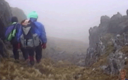
At one point along a little footpath, I passed a chap, with dog (the dog was suitably laden as much as the man was); the chap who a) warned me I was unlikely to get signal again until Salcombe and b) reassured me that the next part of the walk was 'the easy bit'.
Ha. Never trust anyone who tells you that.
They lie.
Anyway, said chap was Chris, and the dog is Moose, and the two of them had been walking for two months for charity. I've had a look on their Facebook feed since, and it's been fun to watch them cover ground I'd covered days previously coming from the opposite direction.
Knowing that I was to be signal-less for the best part of another four hours or so, potentially, spurred me on to take the next few kilometres at a ridiculous, ridiculous pace, still determined, as I was, not to miss that crucial last ferry (!).
To that end, very few photographs thus exist between Prawle and Portlemouth, so I shall just have to paint you a photograph of words to describe the following few hours.
I'll try and keep it short.
Fuelled by that need to hit Portlemouth by four o'clock – and I looked on-track to be able to make that – I bypassed a 'lunch stop' of sorts and feasted on apples, cheese and Snickers (I know, far from a balanced diet but I was convinced that if I stopped for too long I'd lose precious time and lose my chance to cross at Portlemouth).
As a result I started going a little bit stir-crazy, started losing my footing here and there and getting hugely and vocally annoyed with myself (which you can do when you're more or less alone but which is not healthy and I'll tell you for why in a moment).
I also kept misreading three-way signposts (seriously, National Trails, if you're going to point people in three directions different, make that clearer.
At one point I descended some steep steps, slipped a bit and fell on my sizeable backside:

cursed a bit, carried on down and ended up in a small, rocky cove (possibly Chivelstone but don't quote me on that) that had no way back onto the path except to turn and go back the way I came. Nice cove as it was, I'd misread the flippin' signpost, and had to retreat up again and pick up the proper route. I was not 'appy.
This was compounded by the fact the mizzle turned into rain for a while, and coming towards Prawle Point, the rock obstructions on the path were insane.
Imagine this:
but, OK, on a slightly smaller scale and in mizzle-rain.
I refused to put on my raincoat or poncho, though; I am, after all, a Hardcore Harwood (and I'd get my reward in the BnB later).
Glory be, though; after passing the Coastguard's Lookout (the most southerly point of Devon), giving the coastguard a wave, and on meeting the path at the 18k point (around 3.15pm), not far from Gara Rock, I got signal!

(Turns out that nobody was too worried about me, so that was a relief; it was par for the course that signal would inevitably drop out at the End of the World!)
A word about walking alone (under the influence of hormones)
At some point on this particular day I noticed that the dialogue I was having with myself as I navigated cliff edges, rocks, steep descents, steep ascents ... basically all terrains ... was taking a decidedly mean turn.
Again I'll cite hormones as a root cause, as well as a degree of hunger, anxiety about meeting my time targets and getting to Portlemouth for about four o'clock to make sure I caught that ferry, and general tiredness from not stopping for most of the day.
But I got to a point, shortly before I got my signal back (and that didn't help, being cut off from being able to make my two-hourly check-ins), where I realised that if anyone else had been speaking to me the way I was speaking to myself, I'd have given them a sharp poke with a pointy Nordic pole and sent them off the edge of the cliff.
It was around this time I worked out I was only about 3k from East Portlemouth (well, I was actually closer to 4k but, eh); and the end of the day's walking was in sight, but having miscalculated this distance slightly, I reached a point somewhere around Sunny Cove/Mill Bay, when I could even see boats moving in and out between Portlemouth and Salcombe, that I surrendered to my anxiety – and rang the ferryman; he reassured me the last ferry would be at six o'clock, and if I missed it I could give him a ring and he'd come and get me.
It had just gone four o'clock.
I hadn't needed to worry all day.
I was no more than a kilometre from Portlemouth but having literally literally beaten the heck out of the path for the best part of three kilometres since getting back signal, I was finally able to relax, and make the most of the last minutes of trotting, down into Portlemouth.
I even gave myself a pep talk, reminding myself that, eh, I'd just walked another 20 hardcore kilometres over some of the dodgiest, rockiest headland on the south-west coast, and survived, and only had to stop once for a stealth pee in a wealth of bracken and why am I sharing this with you? Who knows?
Basically, by the time I found the ferry landing, and saw the ferry (a little dinghy, really) crossing towards me, I was both spent from physical exhaustion, and elated from having made it, and from being utterly, utterly bad-ass (for me, anyway).
Salcombe, of course, was just as hilly as Dartmouth, and it was something of a wrench to walk up the insane steps up alongside the Ferry Inn and then up two or three sloping paths to the BnB but my word, the relief when I got to hoik off the Monster, and the absolute flamin' bliss of a very hot shower washing away all the mud and exhaustion of the day.
Best. Shower. Ever.
After a short limp up to the local Spar for dinner (BBQ wrap, San Pellegrino, chocolate ...), I settled in my room for the night, to take in three consecutive episodes of You've Been Framed – and this film:
Incentive, if ever I needed it, that clambering the rocks and hills of Devon was absolutely my limit.
Thursday 13th September
Day Four: Salcombe to Hope Cove – the last leg

After an epic night's sleep, waking to a glorious, clear-skied sunny day, and enjoying a truly delightful, slow-paced breakfast (great coffee) at the BnB (plus a chat with other residents of whom three were also SWCP walkers going the 'right way') I was ready to check out around nine.
I headed into town to treat myself to a new pair of socks for the last leg of the walk, to treat my increasingly mullered toes. (The socks, from Fatface, had camels on them. A gift indeed.)


I was decidedly less ... frenetic, and less fixed on keeping time, although I wanted to arrive in Hope around the same time as the parents, who were driving across from Dorset.
However, and I've gone a little out of chronological order, here, I'd had something of a Sign; when I'd gone into the Spar the night before to pick up dinner, the radio in the shop started playing this song, which on a particularly challenging day (that is, a totes emosh hormonal day) can actually reduce me to a blubbering wreck (thankfully, not on this occasion in the middle of a Spar in Salcombe):
I needed this message like you wouldn't believe.
The coast path per se did not recommence out of Salcombe for a good couple of miles or so, past the Overbeck's National Trust estate, but the way towards it looked oddly familiar; the parents and I had actually walked from the car park at North Sands to Salcombe and back again some eight – eight! – and a half years ago while on holiday in Hope Cove over Pa QB's birthday; suddenly nothing felt particularly far away from anything else.
 |
| {2010} |
 |
| {2010} |
 |
| {2018} |
 |
| {2010} |
 |
| {2018 – I know, it's a door; but it's quirky.} |

 |
| {North Sands} |
 |
| {South Sands} |
 |
| {Spod with last-day euphoria face} |
 |
| {Oh goody, more rocks to clamber over ...} |
 |
| {You are kidding, right? Oh, wait, yes, steps to the left. All good.} |
The way was more or less straightforward and clear, with a few hills and dales, rocky paths and bridges; I was even ready to plug into the iPod and mark the last few k with a bit of tuneage, except after I'd listened to it on Tuesday evening on the way to Stokenham I must have left it playing as it was out of battery (sad face).
I only had one truly narky moment around Soar Mill Cove, where the path seemed to split, and the signpost gave absolutely no indication as to which way led to the summit (yes, I went the wrong way, got stuck in gorse, of course, and yet again had to retreat, and try again, at the expense of, oh, three minutes of my day – my new mantra, muttered under my breath, "uhhh, newsflash, signposts are supposed to be helpful to walkers!"
But I really couldn't be grumpy for long (well, I needed to preserve what puff I had left); the views along the last stretch, entering more familiar territory, were just glorious.
Cue the Carpenters earworm.

 |
| {Not too shabby.} |

 |
| {Ack, gone a bit out of sequence here but, here be fields behind Soar Mill Cove} |
 |
| {Soar Mill Cove} |
At around midday I stopped to check my bearings and whereabouts, and reckoned it would take me at least another two hours to reach Hope Cove – I'd left Salcombe proper at around ten, so I was at least halfway.
I'd begun to get extremely beleaguered (and hungry, thank goodness for the apple I'd picked up at the Spar in the morning), and I parked on a bench at the bottom of another hill to have a quick rest and an eat.
No sooner had I come over the hill did I see a building up ahead; this was Ocean's Reach (a new complex built on the site of the old Port Light pub where we'd gone for the old man's birthday lunch in 2010); I was insanely close!
Euphoria kicked in again. If my right toe hadn't felt like it was about to fall off completely, I might well have skipped. Skipped, I tell you. Just a couple of k after passing Ocean's Reach, I glanced down into the valley, and there (under a dubious looking cloud cover) was Hope Cove itself! Sorry. Hoooooooope Cooooooove!
Life360 told me that the parents were incoming in the car; our timing couldn't have been more impeccable.
As much as I could after three days of walking, and wearing a rucksack that very possibly weighed more than a small child, I bounded over Bolt Tail:


At some point over Bolt Tail my written instructions, which had been attached to a lanyard and relegated to the back of my rucksack where they had fluttered about for the best part of this last journey, broke free and flew away; I managed to catch them but it felt like a particularly symbolic moment.
Eh. I guess you had to be there.
The last photograph, above, marks the final descent of my journey, into Hope Cove.
At the bottom of the woodland path there they were, Ma and Pa QB, papping me like lunatics as I finished a fairly fun-filled, but, let me say for the record, gruelling little odyssey.
 |
| {Manic, and looking ... rotund, but happy!} |
Thus began four and a half days of rest, relaxation, food, fun, sun, silliness and ... shenanigans.
Right now, as I sit here with one disgusting, bruised (or perhaps mangy) toenail and one bulbous, inflated toe:

(the nail of which may one day depart this life, to the tune of 'El Condor Pasa') I can't conceive of wanting to do another long walk for quite some time, at least not over the terrain I covered doing the South West Coast Path (though I hear the Thames Path is fairly flat; perhaps that's the next go-er).
I also can't quite believe I made it from Paignton to Hope (albeit with a little public transport interlude here and there); I suppose as I've done longer distances in shorter times in one go this felt like it should have been a breeze, but it certainly wasn't.
Why wasn't it? Nothing to do with me being a decrepit, unfit old bag, surely.
Nope.
I blame the hills.
And the rocks.
The descents.
The ascents.
... The terrain, basically. I've never walked terrain like it.
Perhaps I ought (I ought! as Ma would say) to have expected it. But actually, the expectation of tough terrain would have put me off. The guidebooks downplayed just how tough it is, day after day, with a Monster rucksack, and shoes that have shrunk from washing the Wye Valley Challenge mud away.
OK, the guidebooks could not have known that, but you get my drift.
And y'know what, I could not have prepared any more than I did.
I hit my time targets.
I never got 'lost'. If I went off-path even slightly I found my way back again soon enough.
I never ended up walking at night and questioning all my life choices.
I walked like the clappers.
I kept a good, sustained pace for the best of three days. In spite of injury. And mizzle.
And I did all of this alone.
About an hour in to the walk on that last day, I stepped aside to let a group of women come down a hill (it was much harder down than up and easier for me to pause). I stopped to chat to one as she paused to Get Purchase (!) and ask if I had a map (I did, but it was somewhat cleaved to me somewhere).
"So where are you heading off to?"
Me: "Hope Cove; this is my fourth day of walking."
"You're doing this on your own?"
"Yep."
"Wow, you're brave!"
... I hadn't even thought about it up until then but, yep. I am brave.
I am bruised. I am who I'm meant to be ...
And I'm proud of myself.
I thought I knew my limits.
And every day of that trip I pushed them without knowing.
qb xx
Good to see you've also started out on the South west Coast path. It took me 2 years, and most of the time I was doing it on weekends and evenings after work. My most abiding frustration wasgetting hoem for Roz to ask me how many miles I'd done. On some days 5 miles was incredible achievement, and others 18 miles seemed like a doddle. The biggest issue was trying to ensure a suitable finish so that there weren't too many long hikes to start the next leg.
ReplyDeleteHello Snowgood,
ReplyDeleteThank you for your comments! So nice to actually have comments that I can actually publish, and which aren't spam posts which has so often been the case!
The SWCP takes a lot of planning, doesn't it, and in hindsight I might have dialled down the daily mileage and done more, shorter days, so I didn't feel so compelled to power-walk so much of it, and could actually enjoy a stroll rather than a marathon in most cases.
Beth (aka qb)
Does this mean you've walked the whole path then? Congratulations, either way!
Hello Beth, yes indeed - the whole way round. I must have spent more on petrol, cabs and Hotels than most people spend on an several exotic holidays abroad. Would I swap the memories and views for some "destination resort"? No way.
ReplyDeleteI could really identify with your struggles and disappointments, when I did the bit between Torcross and back towards Dartmouth it was pretty miserable weather.
That steep sided valley in your pictures - I remember standing there, on wet grass look at the gradient and in total disbelief. How could it be so steep AND so slippery i the day I was tackling it (in the opposite direction)?
But you just throw caution to one side and make it happen.